Friday, May 26, 2017

The Gunnison River of Colorado

     Mention "Bryce Canyon" and folks instantly visualize the beautiful very photogenic red rocks in Utah. But mention "Black Canyon" and most folks draw a blank. Maybe because it's too deep and rarely gets sunlight; so it's too black to see clearly? It's tough to get a great photo; it's not photogenic.


     Officially known as "Black Canyon of the Gunnison (River) National Park", this park had 238,018 visitors last year. To give a perspective, Bryce Canyon had 2.3 million visitors last year. I don't like crowds, so this park was perfect to visit.


Like the Grand Canyon, it has a south rim and a north rim. The drive to the South Rim was initially on a dirt road.


The snowy Colorado Mountains are everywhere!


     The canyon is deceptively hidden. In this photo below, the foreground is the Rim Rock Trail on the south rim where I was walking. The background, upper half of photo, is the north rim. See the North Rim Dirt Road? It's closed during winter months.


But there's a canyon there in the middle!


     After setting up camp at the South Rim Campground, I walked about one mile on the Rim Rock Trail to the Visitor Center where there is an outlook.


     At the outlook, I'm astonished at how deep it is; the canyon's average depth is 2,000 feet straight down. This is not a good park to visit if you suffer from vertigo.


I hiked the Uplands Trail back to the campground. All the trails were easy; didn't need to wear boots.


     The best way to appreciate this vast dark deep canyon is to visit each lookout point along the 7 mile South Rim Road. To make it more fun, I rode my electric bike (mostly uphill) to each point, starting at the South Rim Campground and working my way counter-clockwise to "High Point".


     There are very limited casual recreational uses here! Not even the Ute Indians explored the canyon. But several hardy brave souls tried to explore this river (click here for short list). The most thrilling exploration is Abraham Lincoln Fellows' 1901 expedition (click here for that story).


     I talked with a ranger who was looking below with binoculars. He was checking on the 9 people who had special permits to hike below. The limit is 15 people daily.


It's hard to photograph this vast canyon. See the patch of trees next to the needle-like plateau, upper left?


Here's a zoomed-in look at that patch of trees; they're probably 20 feet tall.


A most welcomed small pool of water for wildlife.


Trees struggle here.


Cedar Point is beautiful.


Twisting . . .


and competing for life.


     The Painted Wall, another sight along the South Rim Road, is the tallest vertical wall in the state of Colorado, rising 2,250 feet high. I couldn't get it all in one photo!


A better attempt at it . . .


Another attempt.


For perspective, the 2,250 foot Painted Wall is almost twice as high as the Empire State Building.


The Gunnison River is classified as Class V . . . .


. . . and way beyond, unnavigable! Have never seen such a frothy river.


Here's what the river sounds like from 2,000 feet above it.


The Black Canyon gets very little light.


I tried a panoramic photo, but it doesn't give a true perspective of the canyon's magnitude.


This handsome little guy with yellow toes is a collared lizard.


Beauty among the beastly boulders.


     The "Warner Point" hike (1.5 miles, more suitable for boots and poles, several ups/downs, highest elevation is 8,293 feet) offers a dual view.  To the north, the 2,700 foot deep Black Canyon, and to the south, a valley (photo below) that is irrigated by the Gunnison River.


See the three people hiking in front of me on the Warner Point Trail?


    In a lively conversation, I discovered they lived in the Houston area; he worked for Exxon as an engineer. They've been married 50 years and are triple-citizens (England initially, then Canada and the United States). His job took him to Colombia, Nigeria, El Salvador, to name a few countries. Eighteen years ago (he's 73 now, his wife is 69), when he was 55 years old, he retired due to stress in his job, vowing not to die of a heart attack at 55 years like his father did. But surprise, surprise, two weeks before his retirement day, he had a heart attack! He recovered and they eventually moved away from Houston and the hustle-bustle of the city. They now live nearby the Black Canyon in Montrose. Her brother (in the middle of photo, he's 66 years old) was visiting from England. It was fun meeting these friendly "local" folks.


     Back at High Point after the Warner Point hike, I begin my bike ride "home" to the South Rim Campground. It's already been a long day, about six hours of hiking and uphill biking to all the points, perhaps six miles total hiking and seven miles biking one way. But the seven mile bike ride to my campsite was my Big Adventure!


     Google Map calculates it would take 47 minutes to ride back to the campsite, but I did it in about 15 minutes, and more than half of it without using my electric motor. See all the curves in that road? That exhilarating very scenic ride mostly downhill will be a life-long vivid memory!


Thursday, May 25, 2017

Colorado's Million Dollar Highway from Durango to Montrose

     After experiencing ice, snow plows and salt trucks at the Wolf Creek Pass (Continental Divide, elevation 10,857 feet) a few days ago, I was apprehensive about taking "The Million Dollar Highway". Heading north from Durango, there would be three passes: Coal Bank Pass (10,640 feet), Molas Pass (10,970 feet), and Red Mountain Pass (11,908 feet). And the snow wasn't melting at all!


See the speed limit sign?


That soon changed.


Fabulous scenery!


No doubt about it, Colorado is colorful.


I had to stop and take a photo almost every couple of miles. The road is at the bottom of this photo.


One of many S-curves.


I finally reach the scenic outlook pull-out for Molas Pass.


Tried the panoramic feature on my new camera.


The temps were a notch above freezing.


From Durango, elevation increases 7,651 feet to the highest pass, the Red Mountain Pass. See the road center right?


There's a million dollar view at every turn.


This is a solid rock tunnel.


     And in photo below is Bear Creek Falls falling a couple hundred feet near the historic (and too touristy for me) mining village of Ouray. For a history lesson about Otto Mears who first built an important section of this "impossible" highway in the 1880s where Bear Creek Falls is located, between Silverton and Ouray, click here.


Ouray sits in a canyon of sorts, the Upper Uncompahgre River Canyon (where canyoning/canyoneering is popular).


    Million Dollar Highway is an accurate term. And the reason why some road sections have NO guard rails, by the way, is because there is no ground, no earth, to anchor a guard rail. The paved road at some sections appeared to be a cantilever road, suspended over nothing.


     The Uncompahgre River in case you're curious flows north from its source at Lake Como near Ouray, for about 70 miles, and then dumps into the Gunnison River near Delta, Colorado. 
     Coming up in my next post, the magnificent Gunnison River. It began cutting an amazing chasm through rocks about 15 million years ago. 


Sunday, May 21, 2017

Durango's Alpine Glow

     My weekend visit to Durango has me glowing with admiration. I've been camping at the La Plata County Fairgrounds located downtown Durango and waking up to an alpine glow.


     Durango is a little town, its' population is only about 20,000 people, but it has numerous top-notch, impressive amenities. Consider the fairgrounds for example, there's space for six RVs (electric, water but no sewage connection and no pull-throughs). Notice that three of the six sites have Class B's in photo below? There's a Ford (from Utah) to the right, in the middle is a Sprinter (fulltimers of three years who's "very large" motorhome is at the shop, they tow the Sprinter), and me on the left. A hop and skip away is an excellent recreation center with an indoor heated lap pool (from 5:30 to 10 AM they offer current, vortex, and warm lap lanes which is unheard of elsewhere!) and separate pools for kiddies. Ms. Sprinter (fulltime RVer) agrees this rec center is one of the best in the USA.


     To the north of me, about 30 yards away, are two large ball fields with impressive lighting systems, and 70 yards behind me are an arena and barn for livestock shows.


The red spot shows where I camped.


     All this for a county population of only 55,000 people? And if its man-made amenities aren't enough, there's the gift of its best amenity, a natural one, the Animas River.


     Along side the river is the paved "Animas River Trail" which is popular among bicyclists, dog-walkers, strollers and commuters.


Ladies' day out; walking a baby-stroller and two dogs.


This couple stopped at a riverside patio for beverages. Everyone on the trail was very friendly.


Some folks come to the trail just to read.


Some folks come to hang a hammock and read a book by the sound of the river's gentle rapids.


Some folks fly-fish.


Center of photo shows another raft.


This river has a Class II - III designation.


     Further down the river is a challenging spot. That "surfer" found a sweet spot where he can stay stationery for about five minutes if he balances himself well.


There's even equipment to crank over the river for its annual slalom event.


     My bike ride on the Animas River Trail was about five miles down the river. They spared no expense in building this path.


This is a long concrete downhill bridge with an overlook; mucho bucks!


A squirrel posed for me.


A mule deer buck posed for me too.


But he was more interested in tasty new leafs.


A great-looking multi-housing complex along the riverbanks.


Wonderful outcroppings.


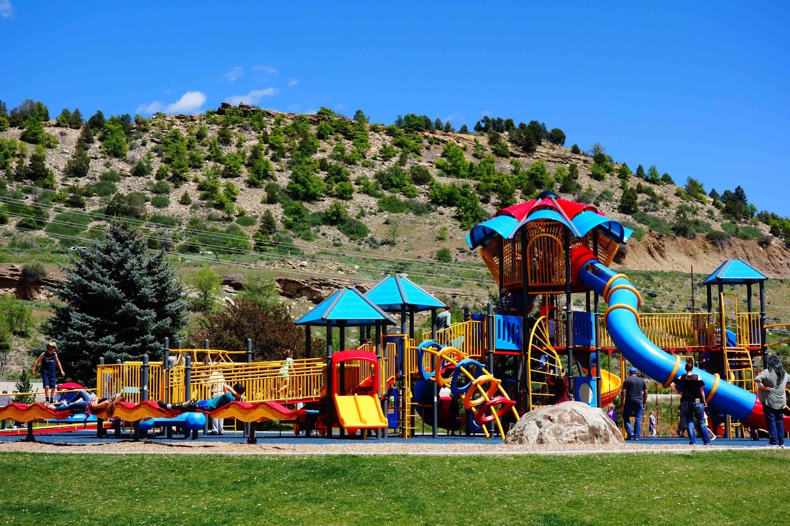
A swanky playground!


Near the playground, an assortment of chimes to play.


The view at the end of the trail . . .


Couldn't decide which photo to use here, so I'm posting both!


     Back in the town of Durango, I stopped along the river trail to admire the city's skate park. Bicyclists and skateboarders were doing acrobatic twists and flips.


And there's a bandstand of course! apparently well-used too.


And a fish hatchery.


     The local 4-H Horse Club held events at the arena behind my campsite this weekend. It was mostly teen girls.


     They had several competitive events. One event, lope over close to the barrel with a flag on top, the rider picks up the flag, lopes to another barrel, and puts the flag in the bucket. It's an easy thing to do if the horse understands what the rider wants to do . . . this horse didn't understand and it's the rider's fault.


This horse understood, but it didn't want near that crazy flapping flag!

There was the traditional barrel racing, too.


For an explanation of Durango's history and how it got its name, click here.