It all started innocently enough by pulling over to do a little biking. A pedestrian there told me to take the spur trail to the Cache River Wetlands Center.
On the spur road, I saw a cypress swamp! I'm thinking "What the heck is a cypress swamp doing in Illinois???"
The Wetlands Center is a super-nice large modern building. It has wetlands landscaping surrounded by trails for self-guided walks but inside, there are wonderfully informative displays showing changes from the ice ages to 19th Century destruction to conservation today.
I saw this display which explained the cypress swamp oddity.
The lady at the Center showed me a canoe trail of the swamp.
And that's all it took to get me in the swamp on my ski about 45 minutes later. It was a very enjoyable paddle, well-marked trail with stakes/arrows, and especially enjoyable knowing there were no alligators!
Back at the bike trailhead, I discovered this bike trail was 45 miles long through the Cache River area. Called the Tunnel Hill State Trail, it is another abandoned railway track converted to a bicycling trail.
It was not muddy at all despite all the recent rains. In fact, it was an excellent gravel trail.
I enjoyed this trail tremendously.
So many photo opps!
Several furry animals and lots of birds, too. This little guy thought I couldn't see him.
A short tunnel . . . .
And a very long tunnel through the rocks.
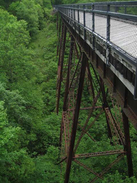
And an iron trestle bridge . . . .
And remnants of a historic bridge.
And another surprise! water flowers in another swampy area.
I concluded my 30-mile bike ride at Vienna, Illinois. Their city park provided me a free office to prepare this posting; free electricity to recharge my bike and use my laptop, free bathroom, and free water to wash my dishes. How lucky can a blogging camper get? Lots of folks stopped by to chat, too.
And by the way, there's an excellent posterboard explanation at Olmsted, Illinois of the Project to Replace Dam and Lock 53 and 54 on the Ohio River. An employee explained how things were done in the old days with steam engines. He was proud to work there, and proud of the lock and dam's history. Very refreshing to run into folks like this.
I really lucked into these experiences. It's all been very sweet at Illinois' Sweet Spot.


Terri lucked out again. I'm a little worried re: iron trestle bridge. Decking looks new but iron supports, way down low, look rather rusty. Eh, maybe my eyes are a little off!
ReplyDeleteGood blog...nicely done.
I wondered too how long those rusted irons will last . . .
ReplyDeleteI'm keeping my eye on your blog. If you come back across Southern Illinois on your way home, you should check out the Garden of the Gods, southeast of Harrisburg, IL... 37.602926,-88.379639
ReplyDeleteVery interesting rock formations. Beautiful in the Fall (October).
Happy trails to you...
Will put it on my list, any other suggestions? I paddled the Hocking River in Logan a couple days ago, popular float river for the locals, but not a destination river by any stretch of the imagination. If you can recommend Class II and under destination rivers in your tri-state area, let me know.
ReplyDeleteWe have a number of great float streams in southern Missouri. Here's a listing of the gauging stations on some of our favorites: http://waterdata.usgs.gov/nwis/current?multiple_site_no=07065200%2C07065495%2C07066000%2C07061500%2C07034000%2C07064533%2C07071500%2C07057500%2C07058000%2C06923940%2C06928000&index_pmcode_STATION_NM=1&index_pmcode_DATETIME=2&index_pmcode_00065=3&index_pmcode_00060=4&group_key=NONE&sitefile_output_format=html_table&column_name=agency_cd&column_name=site_no&column_name=station_nm&format=html_table&sort_key_2=station_nm&html_table_group_key=NONE&rdb_compression=file&list_of_search_criteria=multiple_site_no%2Crealtime_parameter_selection
ReplyDeleteJust Google any of these names, followed by "mile by mile", to get a description and rough map.
If you can give us a heads up when you anticipate being back in our state, we might be able to organize a group to float with you. We use the gauging station info to determine which might make the best float at any given time.
Hope to see you again down the road!
It's a date! can't promise anything yet but have your list bookmarked and will be in touch when I'm traveling south from Canada in August.
ReplyDelete