
First point of interest was Ferndale, California. It's a cute little village of many Victorian homes.

I love the contrasting colors and fences.

See the stained glass window and the corner window?

For a little village, it has a big Victorian Inn.

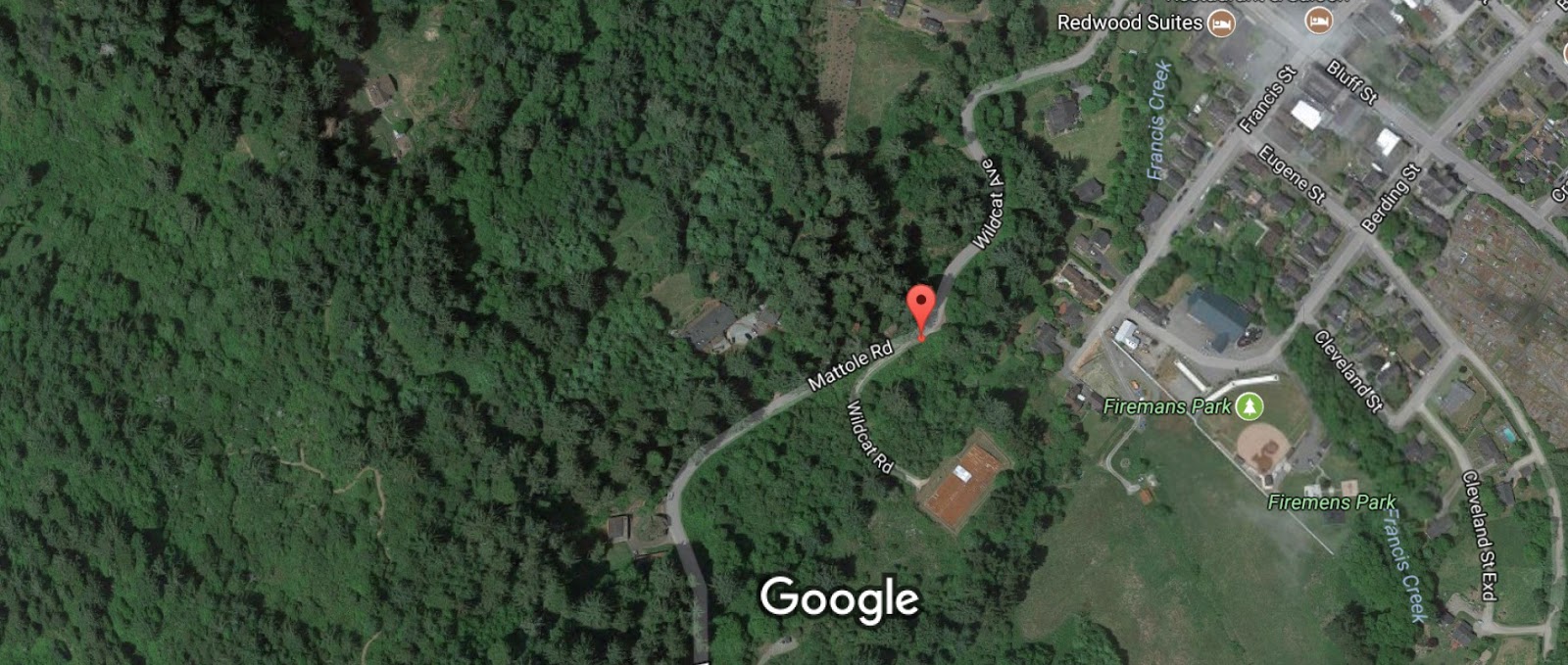
At an odd-shaped tiny spur road off Wildcat Road in the outskirts of Ferndale, my GPS unit found my road, the Mattole Road.
A sign advised against large rigs attempting this road.


One of several bridges.

Some parts of Mattole Road were gravel.

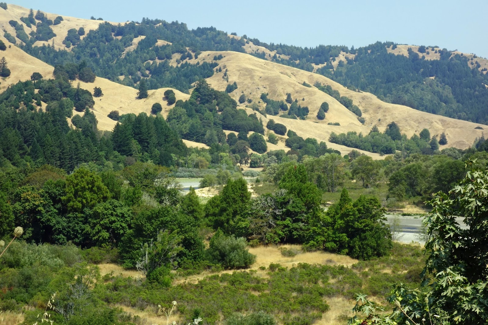
When I approached the top of the mountain, the scenery changed significantly. Initially I thought pioneers had cleared all the trees, but this is natural "coastal rangeland".

Rangeland and isolated homesteads and ranches around every bend. The fog and 20 degree drop in temperature told me I was getting close to the ocean.

The ranchers who live here must be rugged individualists.

Many pot-holes in most places (photo below). Can you imagine trailering all those cows over 20 miles of pot-holes when it's time to buy young cows or take fat cows to markets? I was going 3 miles p/hr over the bad sections and I still had to re-arrange fallen items in the cargo area of La Lair.

Oceanfront pasture!! Who would have thought?

Photo below shows a bit of this area's black sand.

Someone had recently plowed the sand off the road.

I loved this road! Couldn't believe my luck.

I think photo below is "Sugar Loaf Island." Many ships were lost to the jagged rocks at this location so during the early 1800s they built a lighthouse here. But tending to the lighthouse was difficult due to its remote location by land and dangerous seas by watercraft (click here for full story).

I'm now headed back inland.
Unusual mountain . . .

More ranches and beautiful isolation.

Eucalyptus trees.

A very large Eucalyptus tree.

Wonderful "Naked Ladies" along the road.

Plaque on barn says "Built in 1880".

Oops! Steep drop-off too.

I had passed the little village of Petrolia.

I was now entering the Humboldt Redwoods State Park.

Such huge trees! This one had very deep crevices, about 12 inches deep.

"Avenue of the Giants" is 15 miles and what a majestic road to end a day of surprises.

I'm glad I was blissfully ignorant when I began this road.
Yes, Terri, you correctly identified eucalyptus trees. The flowers are Resurrection (or Surprise) Lilies, sometimes called Naked Ladies, presumably because they pop up and bloom without the typical green leaves of other lilies. I bet the late afternoon sunlight on the giant redwoods was a sight to see!
ReplyDeleteThanks Sherman, I edited my post to include your info. There was a forest fire east of Humboldt County (in Trinity County) which created a lot of hazy skies all afternoon near the Redwood Highway (Rt 101) so taking photos was very challenging.
DeleteAh yes, the road less traveled. Bobby Frost would be proud of you. Great photos, as usual. Thanks!
ReplyDelete